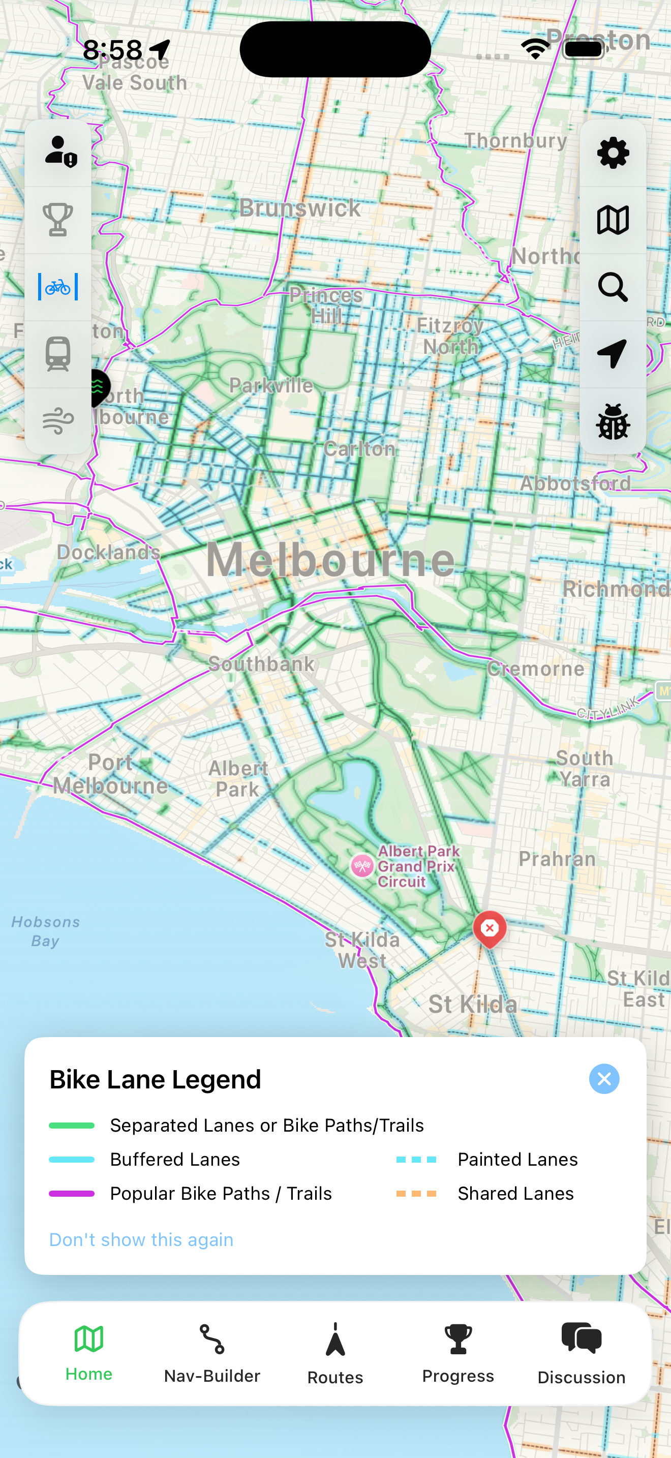
Victoria's only bike path
& cycle lane navigation app
Plan, navigate and discover routes with user-submitted hazards, Big Build detours, live wind and rain animations, real-time transit info and more.
Build a route and navigate in-app or share to your Garmin, Wahoo or other device. No subscriptions, no in-app payments.
Plan your perfect ride
Whether you want the safest route or the fastest, VicBUG helps you navigate Melbourne and Victoria with confidence.
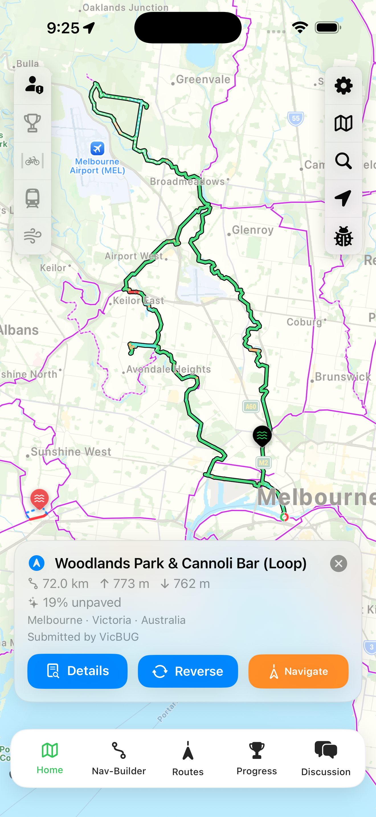
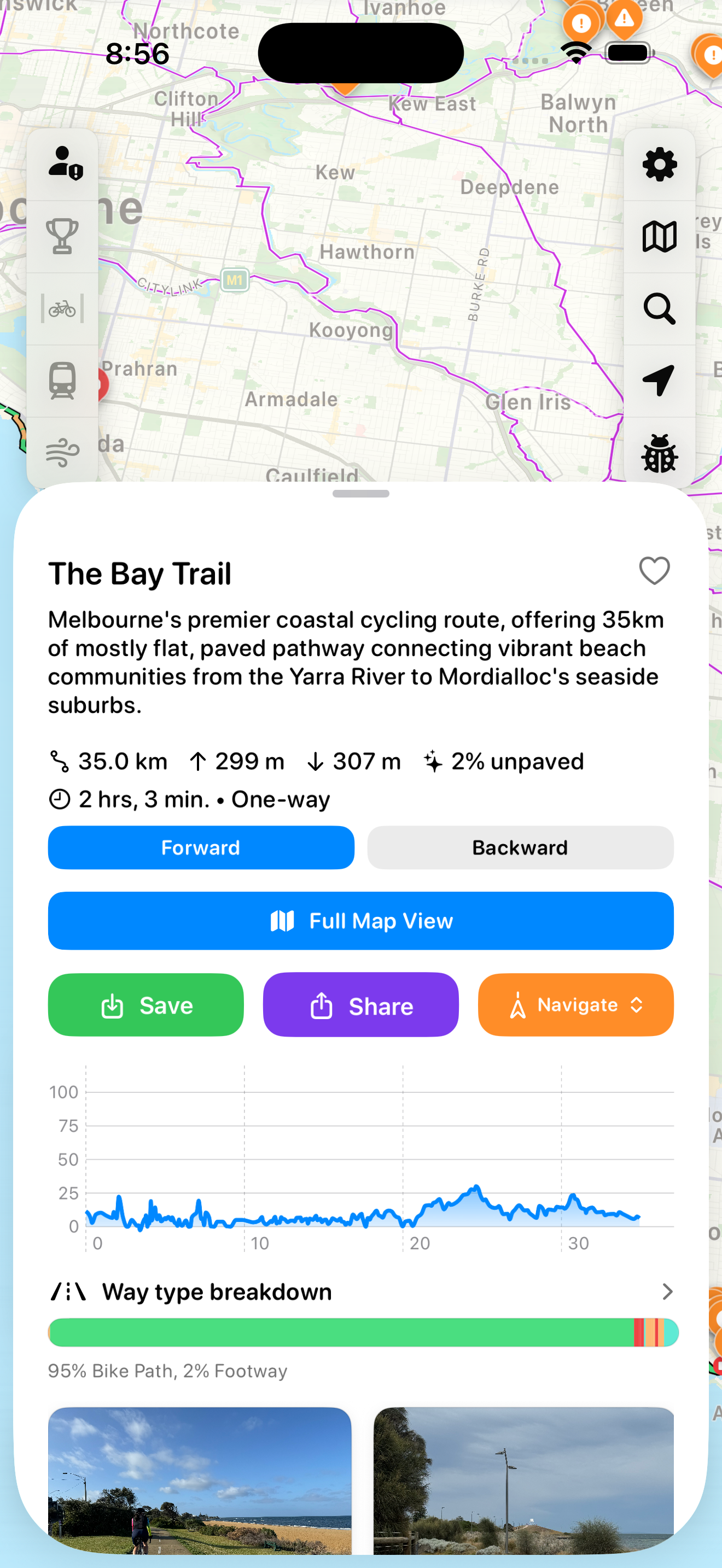
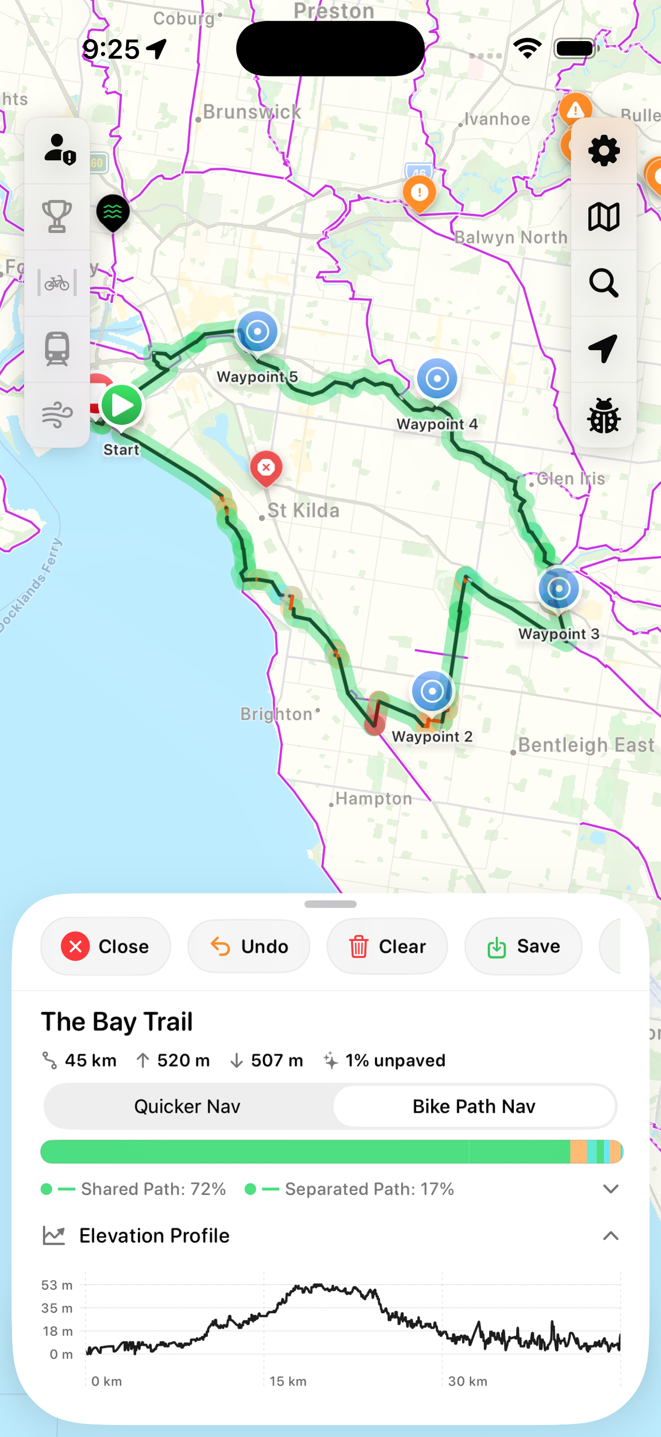
Discover new routes
Browse pre-loaded routes from around Victoria, with distance, elevation and unpaved percentage at a glance.
Choose your route type
Build custom routes choosing bike paths only for safety, or a faster route using cycle lanes.
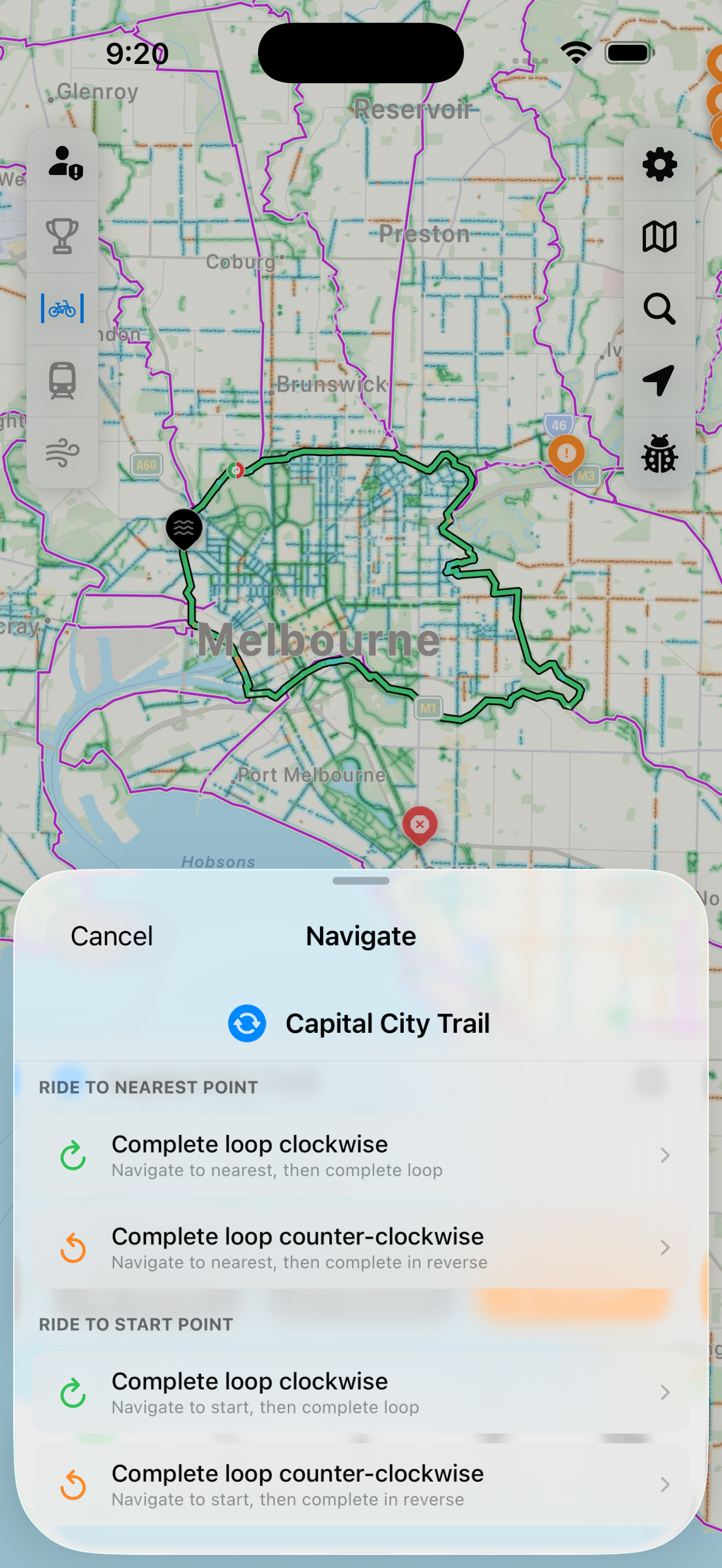
Find the nearest trail
Navigate to the nearest point of any trail from your current location.
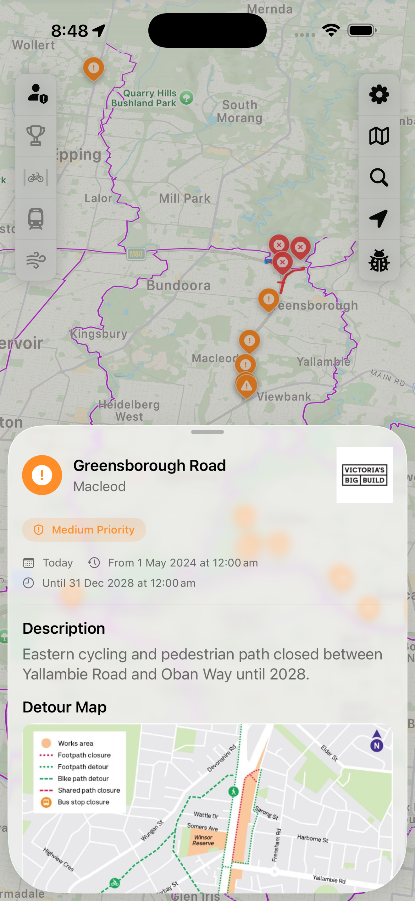
Stay informed on the road
Real-time hazard alerts from Victoria's Big Build and community riders keep you safe and aware.
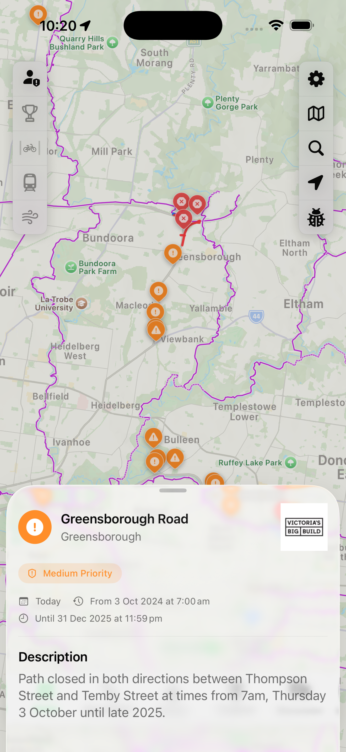
Big Build closures
Official Victoria's Big Build path closures shown on your map with dates, priority levels and detailed descriptions.
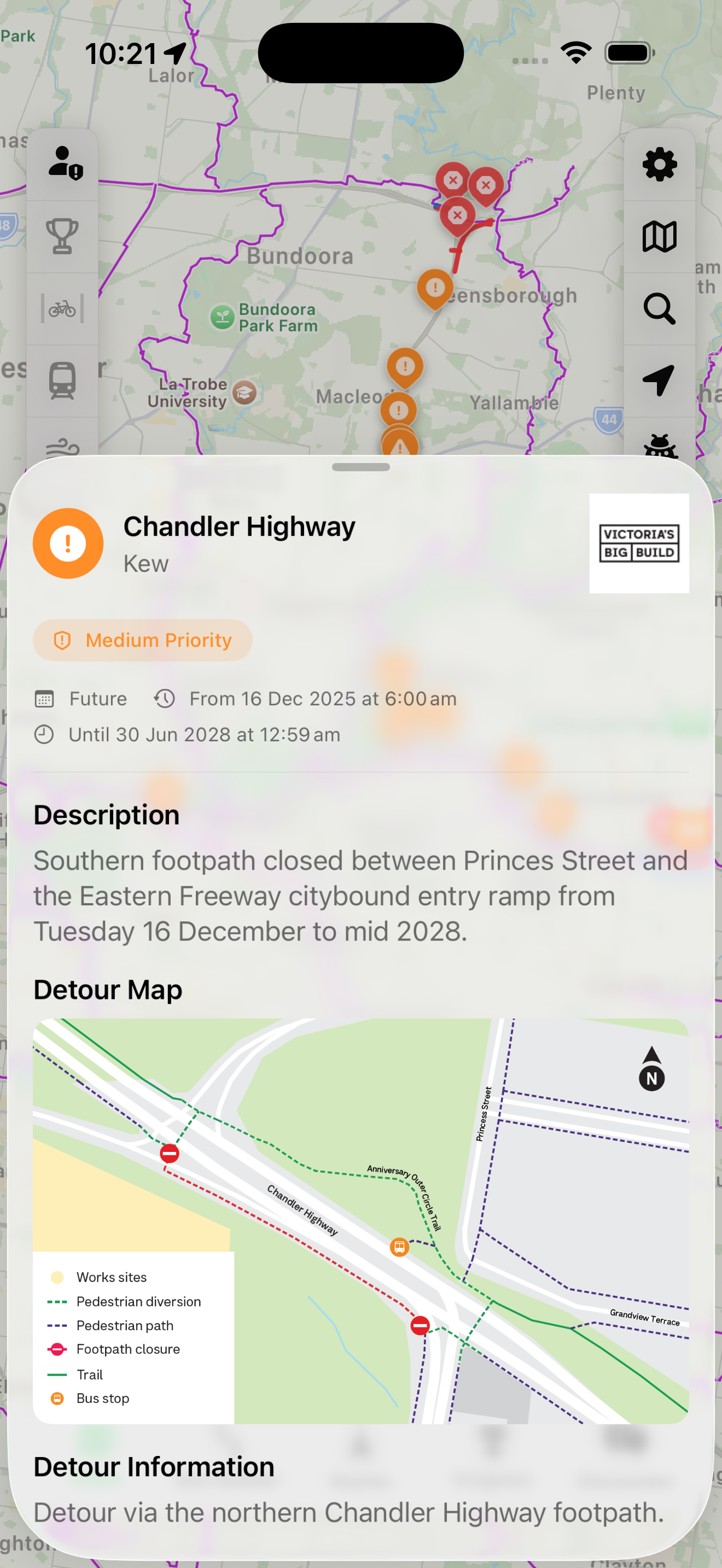
Detour maps included
See official detour routes for each closure, with work sites, pedestrian diversions and alternate paths clearly marked.
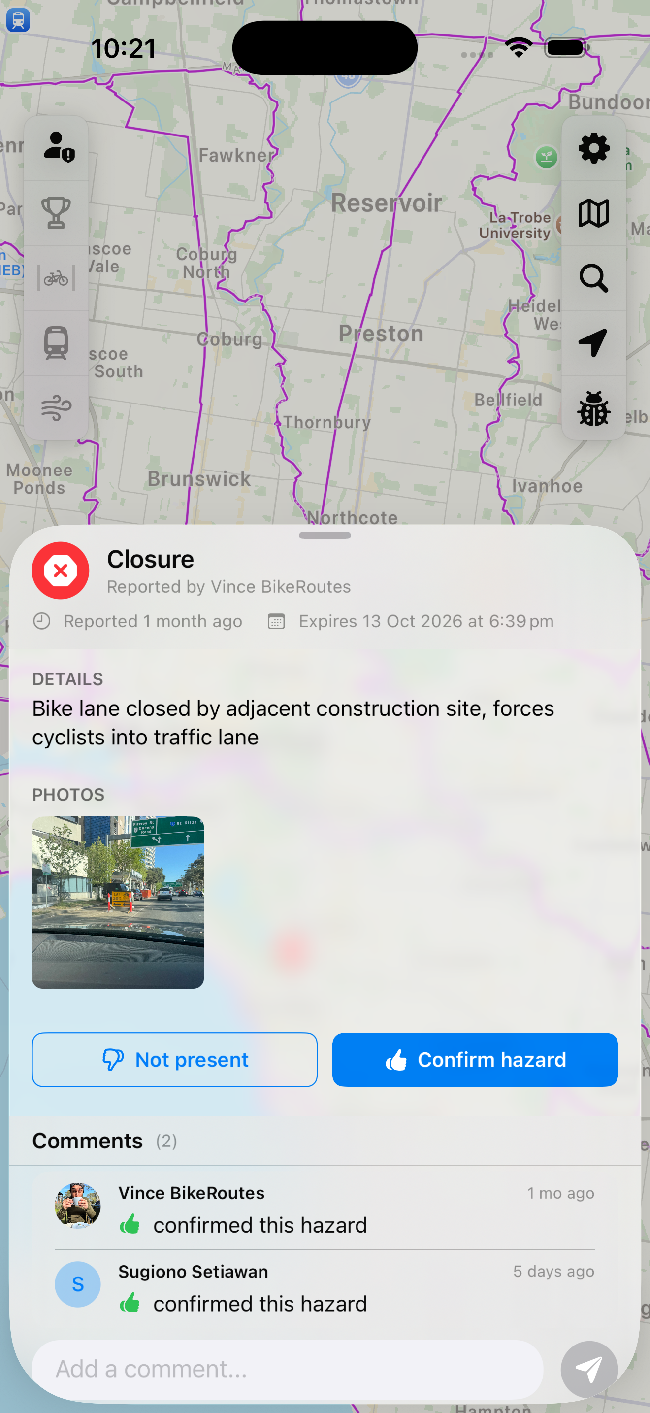
Community hazard reports
Riders report hazards with photos. Confirm or mark as resolved - crowdsourced safety info you can trust.
Live weather & transit
Plan around the weather and catch public transport home with real-time data at your fingertips.
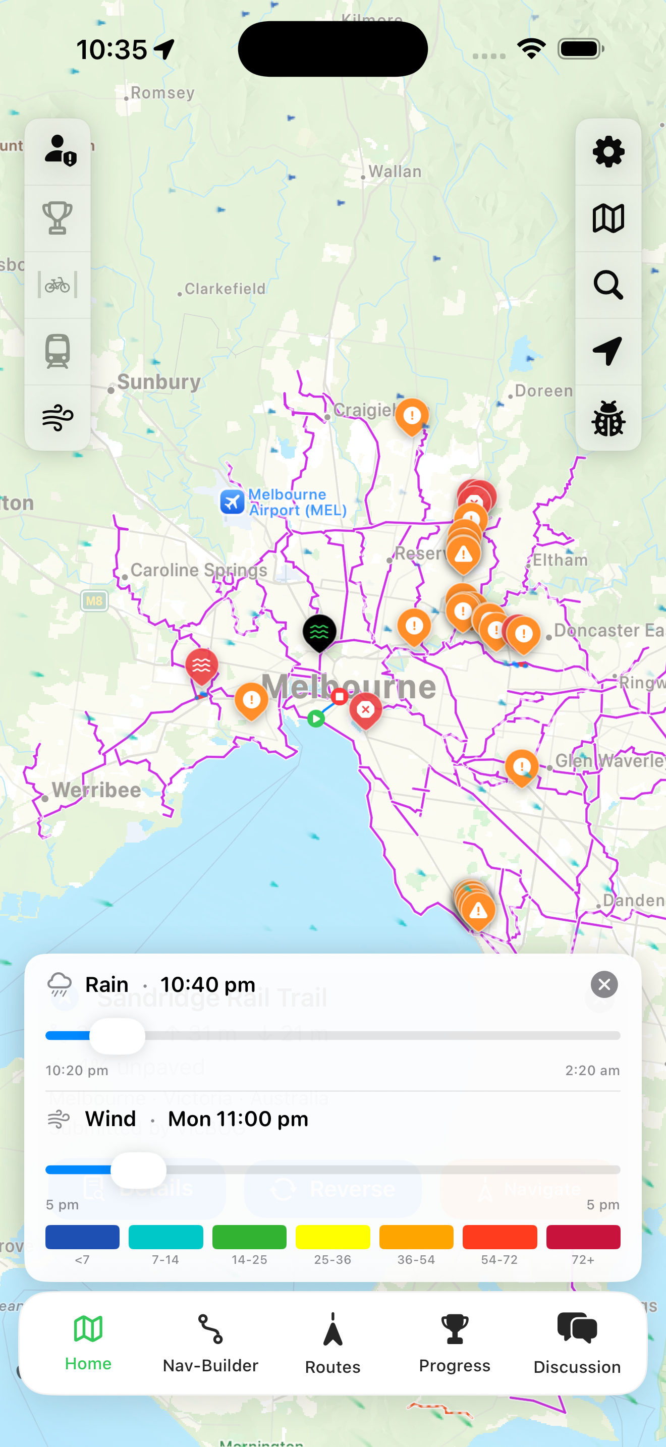
48-hour wind forecast
See wind speed and direction forecasts color-coded on your map. Scrub through 48 hours to plan your ride.
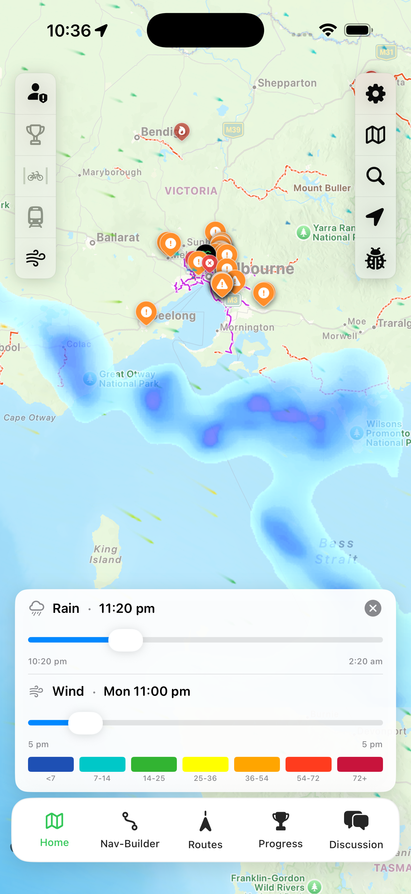
4-hour rain forecast
Animated rain radar shows precipitation moving across Victoria. See 4 hours ahead to dodge the showers.
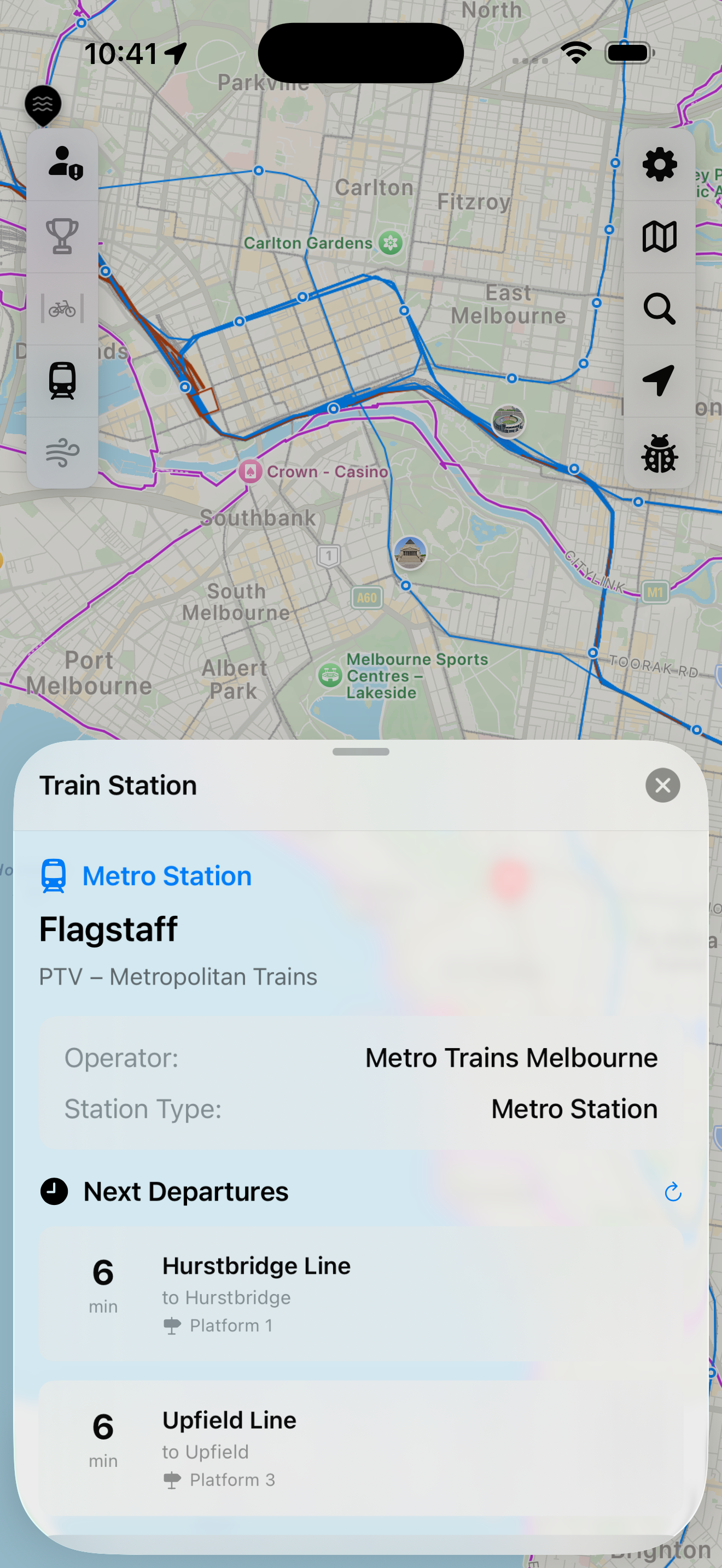
Real-time train info
Tap any station to see live departure times. Perfect for planning your ride home on public transport.
Download VicBUG
Available on iOS and Android.